


Boutique slm
Bons plans










Accueil >> ELECTRONICS AND ELECTRICITY de plongée


276.83 EUR


1.48 EUR

30.73 EUR

37.02 EUR

53.20 EUR

15.55 EUR
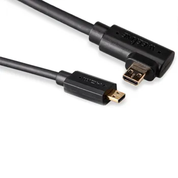
Garmin Nmea 2000 Cable With Right Angle Connector
Garmin Nmea 2000 Cable With Right Angle Connector. Extend your NMEA 2000 backbone with our 6 ft (1.82 m) right angle backbone cable.Compatible Devices:AIS 300 Blackbox ReceiverAIS 600 Blackbox TransceiverGBT 10GDL 40GET 10GFL 10GFS 10GHP 20 Marine Autopilot System for Steer-by-wireGHP 20 Marine Autopilot System with SmartPumpGMI 10 Marine InstrumentGMI 20 Marine InstrumentGNX 20 Marine InstrumentGNX 21 Marine InstrumentGPS 17x NMEA 2000GPS 19x NMEA 2000GPSMAP 1020GPSMAP 1020xsGPSMAP 4008GPSMAP 4010GPSMAP 4012GPSMAP 451GPSMAP 451sGPSMAP 5008GPSMAP 5012GPSMAP 5015GPSMAP 521GPSMAP 521sGPSMAP 527GPSMAP 527xsGPSMAP 551GPSMAP 551sGPSMAP 556GPSMAP 556sGPSMAP 6008GPSMAP 6012GPSMAP 7012GPSMAP 7015GPSMAP 720GPSMAP 721GPSMAP 721xsGPSMAP 750GPSMAP 8008 MFDGPSMAP 8012 MFDGPSMAP 8015 MFDGPSMAP 820GPSMAP 820xsGPSMAP 8500 Black BoxGPSMAP 8530 Black BoxGRA 10GST 10GWS 10Intelliducer Thru-hull Mount Sensor with Depth & Temperature (0-12°, NMEA 2000)Intelliducer Thru-hull Mount Sensor with Depth & Temperature (13-24°, NMEA 2000)Intelliducer Transom Mount Sensor With Depth and TemperatureNMEA 2000 Transducer Adapter KitVHF 200iVHF 300iVHF 300i AIS

31.10 EUR

1554.09 EUR
Garmin Gpsmap 4010 Gps/plotter
Garmin Gpsmap 4010 Gps/plotter. This mid-sized 4000 series chartplotter fills the gap between the smaller GPSMAP 4008 and the wider GPSMAP 4012. Like its counterparts, the 4010 serves as your all-in-one nerve center for the Garmin Marine Network. This chartplotter has crisp, video-quality resolution on a 10.4" (26.4 cm) diagonal SVGA display as well as a worldwide, satellite-enhanced basemap. By connecting to the Garmin Marine Network, you can add sonar, radar and video functionality. For even more enhanced features and detailed regional cartography, you can add the optional BlueChart g2 Vision card (sold separately).View Detailed Graphics and VideoThe 4010 features a worldwide basemap with high-quality satellite images in place of more traditional maps. A high-speed processor draws maps quickly, while its simple, intuitive interface makes navigation easy. To keep tabs on your engine room or other areas of your boat, you also can connect a live video feed through its video input option.Add Extras with BlueChart g2 VisionWith optional BlueChart g2 Vision SD cards, you can add a whole new dimension of exceptional features to your chartplotter.MarinerEye view and FishEye view provide you a 3-D perspective of map information, both above and below the waterline.High-resolution satellite images and aerial photographs help you orient yourself in unfamiliar areas.Auto Guidance technology searches through all relevant charts to automatically create a route from where you are to your destination, avoiding charted obstacles, shallow water, buoys and other obstructions.Connect to the Garmin Marine NetworkThe 4010 connects easily to the high-speed Garmin Marine Network, so you can interface with additional multi-function displays and add remote sensors such as the GFS 10 fuel sensor. Once connected, you can share information between the 4010 and other chartplotters on your boat. You also can add high-powered radar, sonar and video to your system. For easy operation, an optional wireless remote also is available.Specifications: - Display resolution, WxH : 800 x 600 pixels- Display type : SVGA display- Weight : 7.8 lbs (3.5 kg)- Waterproof : Yes (IPX7)- Receiver : 10 Hz high-sensitivity- Antenna : External only- Mounting options : Bail or Flush - Preloaded maps : None- Accepts data cards : 1 SD card- Waypoints : 1,500- Routes : 20- Track log : 10,000 points; 20 saved tracks - Garmin Radar compatible : Yes- Garmin Sonar compatible : Yes (with GSD black box, sold separately)- NMEA 2000 compatible : Yes- NMEA 0183 compatible : Yes- Garmin Marine Network compatible : Yes- Garmin SmartMode compatible (customizable monitor presets) : No- Supports AIS (tracks target ships position) : Yes- Supports DSC (displays position data from DSC-capable VHF radio) : Yes- Tide tables : Yes- Garmin Meteor Audio System compatible : No- Supports Fusion Lync compatible marine radios : No- GSD Black Box sonar support : Yes- GCV Black Box sonar support : No- SiriusXM Weather & Radio compatible : Yes- BlueChart Mobile (planning) compatible : Yes (Wi-Fi Adapter Kit required, sold separately)- Garmin Helm compatible : No- GRID (Garmin Remote Input Device) compatible : No- Wireless remote compatible : Yes- Wireless mouse compatible : Yes - Dual-frequency (50/200 kHz) sonar capable : Yes (with compatible black box sonar)- Dual-beam (77/200 kHz) sonar capable : Yes (with compatible black box sonar)- CHIRP sonar technology : Yes (with external black box)- DownVü : No- SideVü : No- Voltage range : 10-35 Vdc input - NMEA 0183 input ports : 4- NMEA 0183 output ports : 2- Video input ports : 2 - RCA composite- Video output ports : 1 - VGA- Wireless connectivity : Yes (Wi-Fi Adapter Kit required, sold separately)- Garmin Marine Network ports : 3 Whats in the Box:- GPSMAP 4010- GPS 19x NMEA 2000- Bail mount and knobs- Protective front cover- Top and bottom snap covers- Video cable assembly- Power cable assembly- NMEA 0183 cable- NMEA 2000 drop cable- NMEA 2000 10 m backbone cable- NMEA 2000 power cable- NMEA 2000 T-connector & terminator kit- Flush mount hardware- Flush mount gasket- Marine grommet kit- Owner’s manual on disk- Quick reference guide- Installation instructions

1776.21 EUR
Garmin Gpsmap 5008 Gps/plotter
Garmin Gpsmap 5008 Gps/plotter. The GPSMAP 5008 features an unprecedented touchscreen interface, along with a satellite-enhanced worldwide basemap and an 8.4" (21.3 cm) screen that makes navigation as easy as pointing your finger. By connecting to the Garmin Marine Network, you can add sonar and radar. For even more advanced features, you can add the optional BlueChart g2 Vision card (sold separately).View Detailed Graphics and VideoThe GPSMAP 5008 features a worldwide basemap with high-quality satellite images in place of more traditional maps. For even more detail, you can add maps easily with the SD card slot without having to connect to a computer. To keep tabs on your engine room or other area of your vessel, you can connect a live video feed with the 5008s video input/output options.Add Extras with BlueChart g2 VisionWith the optional BlueChart g2 Vision SD card, you can add a whole new dimension of exceptional features to your chartplotter.MarinerEye view and FishEye view provide you a 3-D perspective of map information, both above and below the waterline. High-resolution satellite images and aerial photographs help you orient yourself in unfamiliar areas.Auto Guidance technology searches through all relevant charts to create a route you actually can follow — one that avoids obstacles, shallow water, buoys and other obstructions.Connect to the Garmin Marine NetworkThe 5008 connects easily to the high-speed Garmin Marine Network, so you can interface with additional MFDs and add remote sensors. Once connected, you can share information between the 5008 and other chartplotters on your boat. You also can add high-powered radar, sonar and XM satellite weather and radio to your system.Specifications: - Display resolution, WxH : 640 x 480 pixels- Display type : Touchscreen VGA display- Weight : 6.0 lbs (2.72 kg)- Waterproof : Yes (IPX7)- Receiver : 10 Hz high-sensitivity- Antenna : External only- Mounting options : Bail or flush - Preloaded maps : None- Accepts data cards : 1 SD card- Waypoints : 1,500- Routes : 20- Track log : 10,000 points; 20 saved tracks - Garmin Radar compatible : Yes- Garmin Sonar compatible : Yes (with GSD black box, sold separately)- NMEA 2000 compatible : Yes- NMEA 0183 compatible : Yes- Garmin Marine Network compatible : Yes- Garmin SmartMode compatible (customizable monitor presets) : No- Supports AIS (tracks target ships position) : Yes- Supports DSC (displays position data from DSC-capable VHF radio) : Yes- Tide tables : Yes- Garmin Meteor Audio System compatible : No- Supports Fusion Lync compatible marine radios : No- GSD Black Box sonar support : Yes- GCV Black Box sonar support : No- SiriusXM Weather & Radio compatible : Yes- BlueChart Mobile (planning) compatible : Yes (Wi-Fi Adapter Kit required, sold separately)- Garmin Helm compatible : No- GRID (Garmin Remote Input Device) compatible : No- Wireless remote compatible : Yes- Wireless mouse compatible : Yes - Dual-frequency (50/200 kHz) sonar capable : Yes (with compatible black box sonar)- Dual-beam (77/200 kHz) sonar capable : Yes (with compatible black box sonar)- CHIRP sonar technology : Yes (with external black box)- DownVü : No- SideVü : No- Voltage range : 10-35 Vdc input - NMEA 0183 input ports : 4- NMEA 0183 output ports : 2- Video input ports : 2 - RCA composite- Video output ports : 1 - VGA- Wireless connectivity : Yes (Wi-Fi Adapter Kit required, sold separately)- Garmin Marine Network ports : 3 Whats in the Box:- GPSMAP 5008- Flush mount- Bail mount- GPS 19x NMEA 2000- Power cable- NMEA 0183 cable- Video cable assembly- Marine grommet kit- Protective front cover- Owners manual- Installation instructions

24.06 EUR
Garmin Marine Network Cable Coupler
Garmin Marine Network Cable Coupler. Use our cable coupler to join 2 marine network cables end to end.Compatible Devices:4ft Open Array for GMR 404/604/1204 xHD4kW Pedestal for GMR 404/406 xHD6 kW Pedestal for GMR 604/606 xHDGMR 18 HD RadomeGMR 18 RadomeGMR 18 xHD RadomeGMR 20GMR 24 HD RadomeGMR 24 xHD RadomeGMR 40GMR 404 Open ArrayGMR 404/406 Radar PedestalGMR 406 Open ArrayGMS 10 Network Port ExpanderGPSMAP 1020GPSMAP 1020xsGPSMAP 4008GPSMAP 4010GPSMAP 4012GPSMAP 5008GPSMAP 5012GPSMAP 5015GPSMAP 527GPSMAP 527xsGPSMAP 6008GPSMAP 6012GPSMAP 7012GPSMAP 7015GPSMAP 721GPSMAP 721xsGPSMAP 8008 MFDGPSMAP 8012 MFDGPSMAP 8015 MFDGPSMAP 820GPSMAP 820xsGPSMAP 8500 Black BoxGPSMAP 8530 Black BoxGSD 22 Digital Remote SounderGSD 24 Advanced Sonar ModuleGSD 26 CHIRP Professional Sonar Module

78.48 EUR
Garmin Marine Heading Sensor Cable Nmea 2000
Garmin Marine Heading Sensor Cable Nmea 2000. Connect a heading sensor to a NMEA 2000 network with this 19.7 ft (6 m) cable.Compatible Devices:GMR 18 HD RadomeGMR 18 xHD RadomeGMR 24 HD RadomeGMR 24 xHD RadomeGMR 404 Open ArrayGMR 404/406 Radar PedestalGMR 406 Open ArrayMarine Heading Sensor

78.48 EUR
Garmin Marine Heading Sensor Cable Nmea 0183
Garmin Marine Heading Sensor Cable Nmea 0183. Connect a heading sensor to a NMEA 0183 network with this 32.8 ft (10 m) cable.Compatible Devices:GMR 18 HD RadomeGMR 18 xHD RadomeGMR 24 xHD RadomeGMR 404 Open ArrayGMR 404/406 Radar PedestalGMR 406 Open ArrayMarine Heading Sensor

3.33 EUR
Garmin Update Rate Select Cable For Gps 19x Hvs
Garmin Update Rate Select Cable For Gps 19x Hvs. This cable helps limit output position updates on the GHP 19x HVS antenna to once per second using serial communications rates of 4,800 bps. By default, the antenna outputs position data updates 10 times per second using a serial communications rate of 38,400 bps.Compatible Devices:GPS 19x HVS

671.01 EUR

473.92 EUR