


Boutique slm
Bons plans









Accueil >> PLOTTER-GPS-FISHFINDER ACCESSORIES de plongée


154.70 EUR

Garmin Bluechart G2 Vision Microsd
Garmin Bluechart G2 Vision Microsd. Get a Fresh Perspective
Get a fresh perspective when you take to the water with BlueChart® g2 Vision®.
With BlueChart g2 Vision data, you-ll get detailed marine cartography that provides convenient viewing of nautical content and other premium features. BlueChart g2 Vision allows you to see your vessel-s precise, on-chart position in relation to naviads, coastal features, anchorages, obstructions, waterways, restricted areas and more.
You will also have access to detailed mapping capabilities that include Safety Shading, Fishing Charts, smooth data transition between zoom levels, harmonious transition across chart borders, and reduction of chart discontinuities. Premium features include 3-D perspective above and below the waterline, Auto Guidance, high-resolution imagery, and -real picture- aerial photos of ports, harbors, marinas, waterways, landmarks and other points of interest. It-s the most realistic mapping display Garmin has ever offered.
-Realistic navigation features showing everything from shaded depth contours and coastlines to spot soundings, navaids, port plans, wrecks, obstructions, intertidal zones, restricted areas, IALA symbols and more.
-Smooth display presentation including seamless transitioning between zoom levels and more continuity across chart boundaries.
-Safety shading allows user to enable contour shading for all depth contours shallower than user-defined safe depth.
-Fishing charts to help scope out bottom contours and depth soundings with less visual clutter on the display.
-High-resolution satellite imagery, when overlaid on the chart, provides the mariner with a realistic view of the land and water for unparalleled situational awareness.
-Aerial reference photography provides "real world" photos of ports, harbors, marinas, waterways, navigation landmarks and other points of interest, offering the mariner another powerful tool for navigating unfamiliar waters.
-MarinerEye view 3-D perspective provides a birds eye view from behind the boat showing the chart information for a quick, reliable and easy position fix.
-FishEye view 3-D perspective provides an underwater view that visually represents the sea floor according to the charts information.
-Auto Guidance technology searches chart data to suggest the best passage to a destination. Includes tides, currents, marine services, coastal roads and points of interest.
-Compatible with HomePort- - software that lets you use BlueChart data to conveniently plan and organize routes from your computer before your trip.

42.50 EUR
Garmin Rs232/usb Adaptor
Garmin Rs232/usb Adaptor. Want to connect your GPS to your PC but dont have a 9-pin serial port connection- This cable will get you hooked.
Using this converter cable and the PC interface cable for your unit, you can transfer maps, waypoints, routes and tracks between MapSource and your GPS.
For Windows 95/2000/ME/XP. Not for Windows Vista or Windows 7.

27.19 EUR
Garmin Pc Cable
Garmin Pc Cable. This cable allows you to make a powerful connection between your GPS and your PC.
Now you can create routes and waypoints on your PC and transfer the data to your GPS.
Cable features a standard 9-pin D connector.

45.04 EUR
Garmin Cable Adaptor For 220v Ac+pc
Garmin Cable Adaptor For 220v Ac+pc. Our AC/PC adapter allows you to connect your device to AC power (European, 220-volt) and to your PC.
Features standard 9-pin D connector.

16.99 EUR
Garmin Power + Data Cable
Garmin Power + Data Cable. This power and data cable has bare wires at the end so you can hard wire your GPS directly to a DC power source or some other electronic device.
This allows you to send speed and position data to devices such as a chartplotter, computer, auto pilot, radar, etc.

24.65 EUR
Garmin Marine Software Homeport
Garmin Marine Software Homeport. Before heading out on the open water, plan your voyage with HomePort - marine trip-planning software¹ that lets you plan and organize routes from the convenience of your computer.
Use your existing BlueChart® preprogrammed card, or transfer the preloaded maps² directly from your chartplotter to an SD- card. Then simply plug the card into your computers card reader to start planning your voyage.
Navigating waters with no visible landmarks or shallow shorelines can be a daunting task for even the most experienced navigator. With your existing BlueChart data together with HomePort on your computer, you-ll have the ability to view map details such as underwater hazards and hidden obstacles and plan a route to avoid them.
HomePort also offers features such as depth profiles, distance and bearing measurements, and tidal predictions.
Manage Your Data
In addition to managing waypoints, routes and tracks, you can store information from past voyages right on your computer. HomePort will also help you create point-to-point routes, determine fuel usage and estimate your travel time for each leg of your route - saving you time and money.
View Marine Charts
It-s easy to browse and view chart detail on your computer screen and mark waypoints and other points of interest. When finished, send the data to an SD card or proprietary Garmin datacard to load into your compatible Garmin chartplotter or sounder.
HomePort is compatible with BlueChart, BlueChart g2 and BlueChart g2 Vision navigation charts. It is currently only compatible with Windows® operating systems.
¹HomePort software does not include map data.
²Inland Lakes software is not compatible with HomePort. If using a device preloaded with Inland Lakes software in conjunction with BlueChart g2 and g2 Vision pre-programmed cards, only the pre-programmed cards are compatible.
-displays both fishing and navigational charts from BlueChart g2 Vision
-allows user to measure distance and bearing on the charts
-displays route/track depth profile
-converts tracks into point-to-point routes (track to route conversion) and specifies the speed for each leg of the route
-provides ETA and arrival times (for each leg) when you create routes
-shows animated playback of data collected on device
-calculates fuel consumption (based on fuel flow data provided by the user)
-exports selected data to Google- Earth
-displays statistics and graphical information about tide stations, tidal streams and currents
-displays grid lines to show latitude and longitude
-allows you to manage waypoints, routes and tracks
-allows you to view the map north-up, map-up or course-up
-displays celestial information such as sunrise, sunset and moon phase
-displays photos and point-of-interest detail
-supports vector charts
-includes worldwide basemap
-allows multiple map views

7.21 EUR
Garmin Front Cover For Gpsmap® Series 500
Garmin Front Cover For Gpsmap® Series 500. Protective cover for 500-Series Chartplotters and Sounders

20.82 EUR
Garmin Mount For Series Gpsmap® 400/500
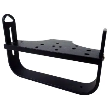
Garmin Mount For Series Gpsmap® 400/500. Marine swivel mounting bracket for the 400/500-Series Chartplotters and Sounders

30.17 EUR
Garmin 220v Adaptor
Garmin 220v Adaptor. Gives ability to charge your unit at home. Includes, USA, Europe, UK and Australia plug adapters

9.77 EUR
Garmin Front Cover For Gpsmap® 620
Garmin Front Cover For Gpsmap® 620. Heavy duty cover that fits the unit snugly, protects screen from getting scratched and guards against the harsh rays of the sun.

65.87 EUR
Garmin Car Mount + Power Cable
Garmin Car Mount + Power Cable. This automotive mount has an integrated vehicle power cable and external speaker for audible turn-by-turn directions.

65.87 EUR
Garmin Marine Mount + Power And Data Cable
Garmin Marine Mount + Power And Data Cable. This marine mount with power/ data cable has swivel/tilt capabilities.
Power/data cable is integrated into mounting bracket.

210.80 EUR
Garmin Gps Antenna 17x Nmea 2000
Garmin Gps Antenna 17x Nmea 2000. The rugged GPS 17x NMEA 2000 receiver/antenna offers high sensitivity reception and pinpoint GPS accuracy to the Garmin family of marine instruments, autopilots and multifunction displays.
Delivers Precise Location Data
This 12-channel receiver continuously tracks satellites and reports your precise position. It is also WAAS-capable, so it can determine your precise location to within 3 meters - without using an external DGPS beacon receiver.
Built for Versatility Use
Part of the Garmin marine instrument family, the GPS 17x is built to withstand the elements. This waterproof sensor can be pole mounted or flush mounted. It also can be attached to the underside of many fiberglass decks for added ease of installation.
Whats in the Box:
◦GPS 17x (NMEA 2000)
◦Pole mount
◦Flush mount
◦Under deck mount
◦Drop cable
◦T-connector
◦Documentation

6.79 EUR
Garmin Indoor Mount For Gps Antenna 17x Hvs
Garmin Indoor Mount For Gps Antenna 17x Hvs. Use our under deck mount to mount your compatible marine antenna under a fiberglass surface.

27.19 EUR
Garmin Video Cable For Series 4000/5000
Garmin Video Cable For Series 4000/5000. This cable supplies audio and video to your chartplotter.
Its left-angle head gives you flexibility when trying to connect it to the chartplotter in a limited space.